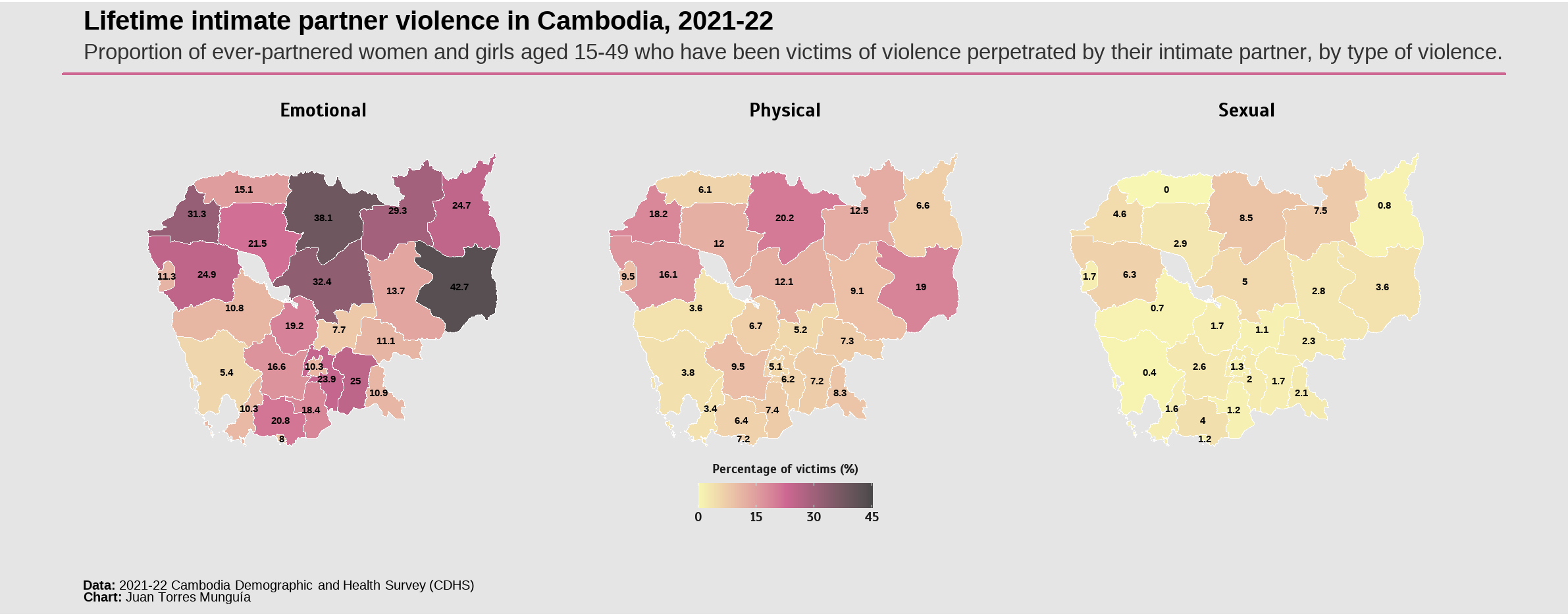
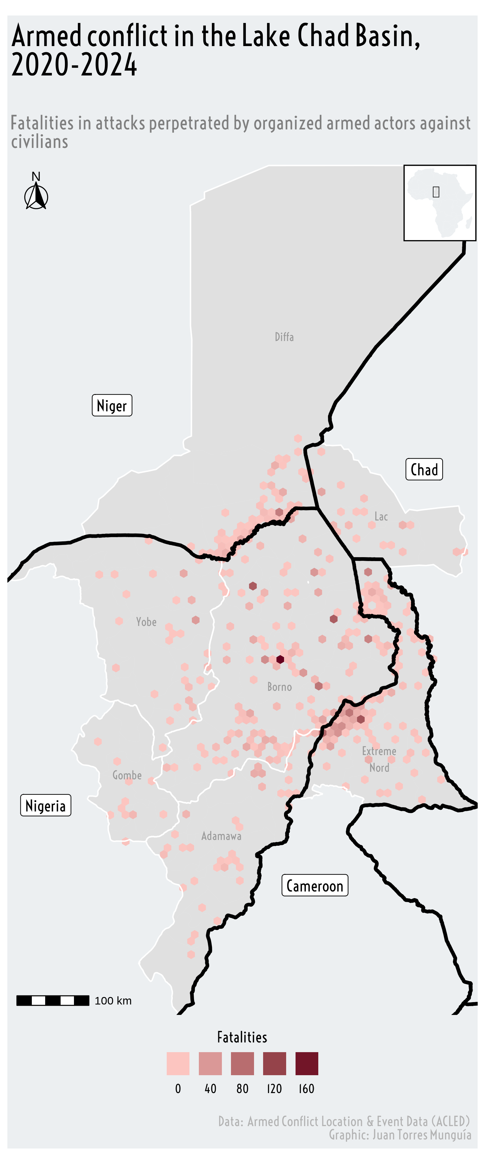
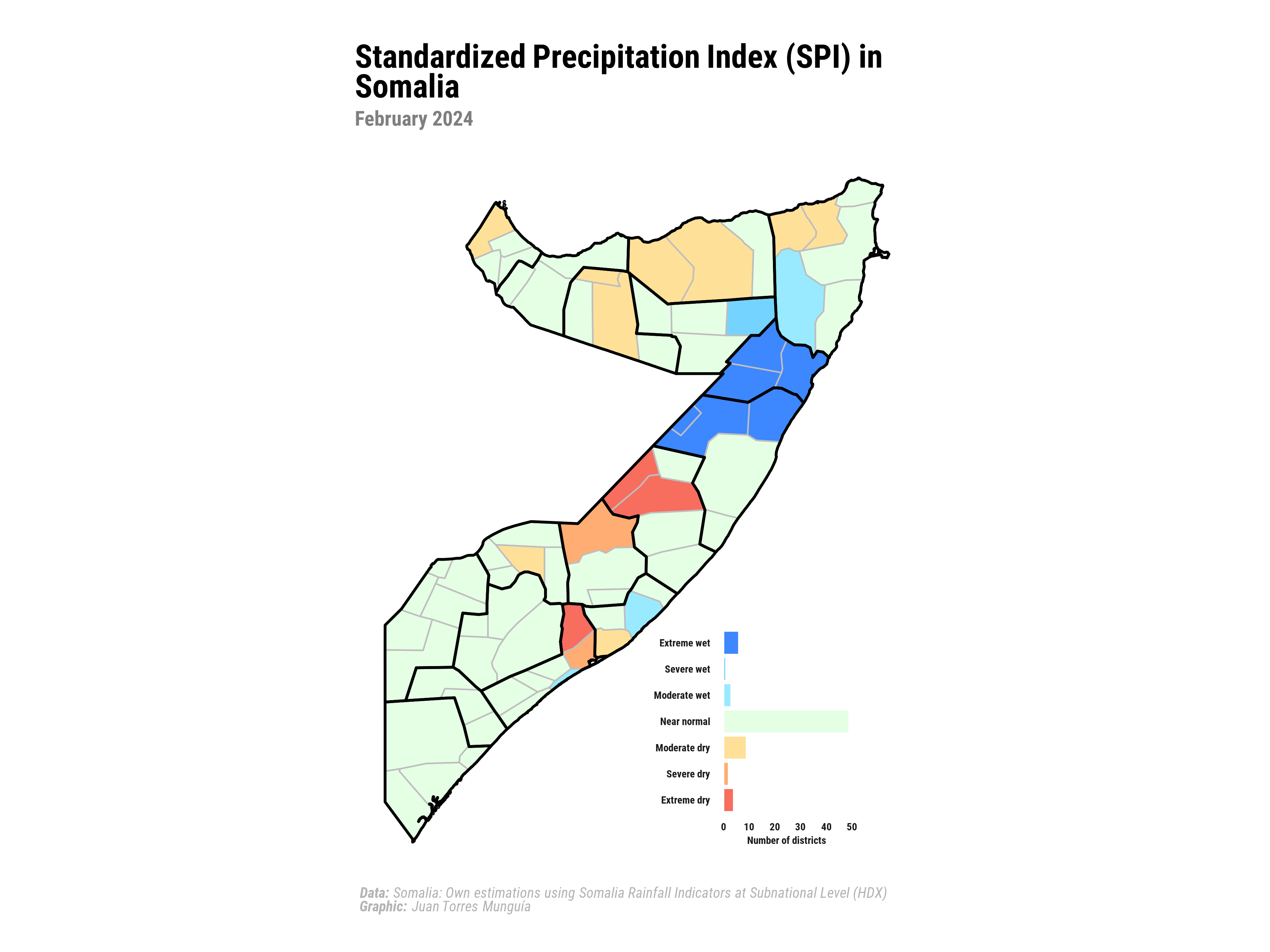
Description
Maps are visual representations of geographic space, used to display the relationship between a phenomenon of interest and its spatial distribution. They can illustrate different types of information, including categorical and continuous data. Maps are essential for identifying geographic patterns and supporting informed decision-making based on location-specific information.